Drone data,
ready for
decisions
.
Precision Cloud is the platform Precision Drones uses to host, analyse, and share farm-scale aerial data — from smallholder programmes to corporate estates and government forestry.


Our impact and growth
Our capabilities — hosting, analysis, sharing.
Beyond data capture, our platform integrates deeply with client operations, delivering raster and vector analytics to any device.
Building trust, delivering excellence — trusted by leading organisations worldwide


See the same plot — every layer.
Visualize and analyze diverse datasets by overlaying them on a unified platform. Precision Drones's advanced feature enables comprehensive analysis and insights through combined data layers.
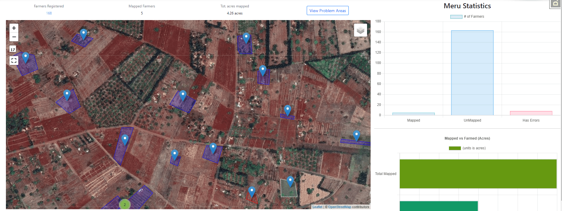
Accelerating Small-Holder Farmers' Mapping and Digitization
Our software is purpose-built for small-holder farmers, focusing on scalability, efficiency, and cost reduction. It provides a cloud-native infrastructure that revolutionizes mapping for hundreds of thousands of farmers.

Adding Phone or Camera Imagery
Enhance mapping projects by integrating ground truthing with aerial data. Seamlessly incorporate phone or camera imagery alongside drone data for improved accuracy and reliability.
Small Holder Farm Utilization Feature
Analyze and assess farmland utilization with our Small Holder Farm Utilization feature. Leverage aerial data and algorithms to gain insights into acreage actively farmed.

Do I need fast internet to view the maps?
What devices are supported for viewing maps?
Is training required to use the platform?
Is there a limit on the number of files that can be uploaded?
Turn your next drone flight into a decision-ready map.
Get in touch and we'll set up a workspace for your programme.
Precision Cloud
© Precision Drones Limited, 2022